Ininerary maka 7 ụbọchị Kimanjaro ịrịgo na-agwọ ọrịa Lemosh
1bọchị 1: Londosossi Park Ọnụike (6000ft) na MTI Mkubwa Camp (8700F)
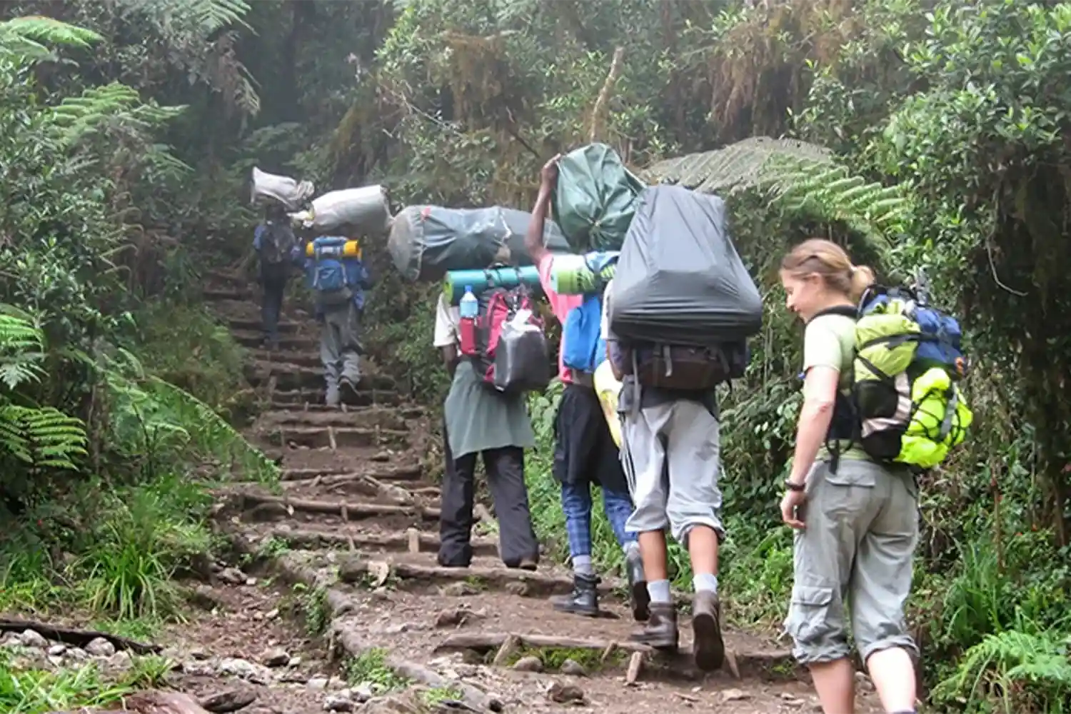
Mgbe ị risịrị nri ụtụtụ na mkpirikpi, na-eduga na ọnụ ụzọ ámá Londorossi (ihe dị ka awa 3) site na ebe a enwere okporo ụzọ na-eduga n'ụgbọala wiil nke na-eduga na Lemosho glad. Soro okporo ụzọ ọhịa na-aga na Mti Mkubwa (Nnukwu Osisi) na-ewere n'otu abalị na nri abalị.
- NGWETA: 1830m / 6000FT rue 2650m / 8700TT
- Anya: 6km / 4mi
- Oge Hiking: 2-3 awa
- Ebe obibi: Ọhịa Montane
Daybọchị 2: Mti Mkubwa Camp na Shira 2 Camp (8700FT ruo 12,600ft)
Mgbe anyị risịrị nri ụtụtụ, anyị na-aga n'ihu dị ka okporo ụzọ ji nwayọọ nwayọọ steepụ ma banye na nnukwu heather moorland Mpaghara. Mgbe a ga-agafe ọtụtụ mmiri, anyị na-agafe Shira Rull n'oge Shira 1 na na Shira 2 n'ụlọikwuu na Moorland ahịhịa site na mmiri.
- Igogo na: 2650m / 8700FT ruo 3850m / 12,600ft
- Distance: 16km/10mile
- Hiking Time: 7-8 hours
- Habitat: Moorland
Day 3: Shira 2 Camp to Barranco Camp (12,600ft to 13,000ft)
From the Shira Plateau we continue to the east up a ridge, passing the junction towards the peak of Kibo. As we continue, our direction changes to the southeast towards the Lava Tower, called the “Shark’s Tooth” (elevation 4650m/15,250ft). Shortly after the tower, we come to the second junction which goes to the Arrow Glacier. We now continue down to the Barranco Camp. Although you end the day around the same elevation as when you began, this day is very important for acclimatization and will help your body prepare for summit day.
- Elevation: 3850m/12,600ft to 4000m/13,000ft
- Distance: 8km/5mi
- Walking Time: 5-6 hours
- Habitat: Semi-desert
Day 4: Barranco Camp to Karanga Camp (13,000ft to 13,250ft)
After breakfast, we leave Barranco and continue on a steep ridge up the Barranco Wall to the Karanga Valley and the junction which connects with the Mweka Trail.
- Elevation: 4000m/13,000ft to 4050m/13,250ft
- Distance: 5km/3mi
- Climbing Time: 3-4 hours
- Habitat: Alpine Desert
Day 5: Karanga Camp to Barafu Camp (13,250ft to 15,350ft)
We continue up to the Barafu Camp. You have completed the South Circuit, which offers views of the summit from many different angles. Here we make camp, rest, enjoy dinner, and prepare for the summit day.
- Elevation: 4050m/13,250ft to 4700m/15,350ft
- Distance: 4km/2mile
- Climbing Time: 3-4 hours
- Habitat: Alpine Desert
Day 6: Barafu Camp to Summit to Mweka Camp (15,350ft to 19,340ft / Down to 10,150ft)
Very early in the morning (midnight to 2 am), we continue our way to the summit between the Rebmann and Ratzel glaciers. You head in a northwesterly direction and ascend through heavy scree towards Stella Point on the crater rim. This is the most mentally and physically challenging portion of the trek. At Stella Point, you will stop for a short rest and will be rewarded with the most magnificent sunrise you are ever likely to see. Faster hikers may view the sunrise from the summit. From Stella Point, you may encounter snow on your 1-hour ascent to the summit. Once at Uhuru Peak, you have reached the highest point on Mount Kilimanjaro and the continent of Africa! From the summit we begin our descent by continuing straight down to the Mweka Camp, stopping at Barafu for lunch. You may want gaiters and trekking poles for the loose gravel going down. We arrive at Mweka Camp and enjoy our last evening on the mountain.
- Elevation: 4700m/15,350ft to 5895m/19,340ft
- Down to 3090m/10,150ft
- Distance: 5km/3mi up / 13km/8mi down
- Hiking Time: 5-7 hours up / 5-6 hours down
- Habitat: Stone scree and ice-capped summit
Day 7: Mweka Camp to Mweka Gate to Hotel (10,150ft to 5,500ft)
Site na ogige Mweeka, ihe na-aga n'ihu njem ha na ọnụ ụzọ Mweeka, ebe ọpụpụ ugwu ahụ. N'ikpeazụ, mgbe ọ rutere n'ọnụ ụzọ Mweeka, ndị na-arị elu nwere ike ime ka ụzọ ha nwere ebe ha nwere ike izuike ma zuru ike mgbe njem ha siri ike na Kimanjaro ..