
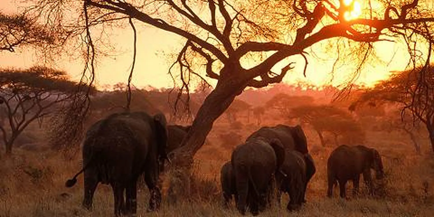
Quick Answer: What Nature and Landscapes Can You See in 6 Days?
A well-planned six-day Northern Circuit safari can show four very different landscape systems: Tarangire's baobab savanna and river corridor, Lake Manyara's Rift Valley escarpment, groundwater forest and alkaline lake, Serengeti's vast plains, kopjes and riverine habitats, and Ngorongoro's volcanic highlands and crater floor. The strongest route is not the one that covers the most kilometres; it is the one that gives each ecosystem enough daylight to be understood, photographed and enjoyed.
Quick navigation: Landscape overview | 6-day route | Park comparison | Nature data | Best seasons | Photography | Planning tips | FAQs
Why a 6-Day Northern Tanzania Safari Has So Much Landscape Variety
Northern Tanzania packs remarkable geological and ecological change into a relatively connected safari circuit. In one trip, the road can move from the lower, drier Maasai Steppe into the Great Rift Valley, across volcanic highlands and then onto one of the world's most famous savanna systems. Water availability, soil, elevation and rainfall determine whether the view is dominated by baobabs, acacia woodland, evergreen forest, alkaline lake edge, short-grass plains or montane vegetation.
That is why a safari should not be planned as a checklist of animals alone. Landscape controls the wildlife story. Elephants in Tarangire National Park are strongly associated with the park's river system and dry-season water. Lake Manyara's forest and wetland habitats support a completely different mix of primates and waterbirds. Serengeti's grasslands make long-distance herbivore movement possible, while Ngorongoro's volcanic landforms create compact but sharply contrasting habitats.
A Practical 6-Day Tanzania Safari Landscape and Nature Route
A common high-variety route links Tarangire, Lake Manyara, Serengeti and Ngorongoro from Arusha. It works because each day introduces a new ecosystem without requiring a domestic flight. Jaynevy Tours already operates a related 6-day Tarangire, Manyara, Serengeti and Ngorongoro safari from Arusha; the exact lodge sequence and drive timing should still be matched to your travel dates.
Day 1: Arusha to Tarangire — Baobabs, Acacia Savanna and the Tarangire River
Tarangire is the best opening lesson in how water shapes wildlife. Tanzania National Parks gives the park an area of 2,850 km² and an altitude range of roughly 900 to 1,250 metres. The river cuts through a landscape of savanna, acacia woodland and iconic baobabs, and becomes especially important as surrounding seasonal water disappears.
In the dry season, the colour palette becomes more restrained: pale grasses, dusty tracks, grey-green woodland and enormous baobab trunks. After rain, the same country can turn surprisingly green. Photographers should look beyond close animal portraits and use elephant groups, giraffes or antelope as scale inside the wider landscape.
Day 2: Lake Manyara — Rift Valley Escarpment, Groundwater Forest and Soda Lake
Lake Manyara National Park is compact compared with Serengeti, but that is exactly why it works as a landscape day. TANAPA gives the park an area of 648.7 km² and describes a mosaic of groundwater forest, acacia woodland, floodplain, papyrus wetland, hot springs and alkaline lake pressed against the Great Rift Valley escarpment.
The visual transition can happen quickly. Near the entrance, dense forest creates shade and enclosed views; farther out, the lake and floodplain open the horizon. TANAPA's current habitat information says more than 400 bird species have been recorded, making the park particularly rewarding for travelers who want nature to include vegetation, water and birdlife rather than only large mammals.
Day 3: Lake Manyara to Central Serengeti — From Rift Highlands to Open Plains
The transfer toward Serengeti National Park is part of the experience. The landscape gradually opens, and the sense of scale becomes the main subject. UNESCO lists the Serengeti World Heritage property at 1,476,300 hectares, equivalent to 14,763 km², and describes about 1.5 million hectares of savannah.
Central Serengeti adds granite kopjes to the grassland story. These exposed rock outcrops interrupt the plains and create shade, lookout points and shelter for wildlife. Late afternoon is especially useful for understanding their shape because low light gives the rocks stronger texture and separates them from the grassland behind.
Day 4: Serengeti — Plains, Kopjes, River Corridors and the Migration Landscape
A second Serengeti day is what turns the park from a drive-through destination into a landscape experience. Depending on your camp and season, the day can include open grassland, wooded drainage lines, riverine vegetation, kopjes and areas used by migratory herds. UNESCO describes the annual migration as a circular journey of about 1,000 km through Tanzania and Kenya involving more than one million wildebeest plus hundreds of thousands of other ungulates.
The key planning point is that the migration is not a fixed attraction. Rainfall, pasture and water influence herd movement. A six-day safari aimed at migration landscapes therefore needs season-specific camp placement rather than a promise that a particular crossing or herd concentration will be in one place on one date.
Day 5: Serengeti to Ngorongoro — Volcanic Highlands and a Major Change in Elevation
Leaving Serengeti for Ngorongoro is one of the clearest landscape transitions in the Northern Circuit. Grasslands give way to higher, cooler country and volcanic relief. UNESCO gives the Ngorongoro Conservation Area a total area of 809,440 hectares, or about 8,094.4 km², spanning highland plains, savanna, woodland and forest.
Ngorongoro is not only the crater. The wider conservation area includes volcanic highlands, short-grass plains and important archaeological landscapes. UNESCO notes that Olduvai Gorge is about 14 km long. For travelers interested in landform history, this day connects present-day safari scenery with the geological and human story of the region.
Day 6: Ngorongoro Crater — A Caldera Full of Contrasting Habitats
UNESCO describes Ngorongoro Crater as the largest unbroken caldera in the world. From the rim, the first impression is topographic: steep crater walls enclosing a broad floor. During a crater game drive, the view changes again through grasslands, marshy areas, woodland and lake-edge habitats.
Because the crater is visually contained, it is easier to read than the endless Serengeti. You can see how water, slope and vegetation divide the floor into habitats. UNESCO's World Heritage profile cites roughly 25,000 large animals in the wider conservation area and around 500 bird species; these figures are useful biodiversity context, not a promise of what one vehicle will see in one day.
Landscape Comparison: Tarangire vs Lake Manyara vs Serengeti vs Ngorongoro
The four areas complement rather than replace one another. If your goal is maximum landscape diversity in a short safari, the value comes from the contrast between them.
| Protected area | Official area | Landscape signature | Nature detail to notice | Strong photo approach |
|---|---|---|---|---|
| Tarangire National Park | 2,850 km² | Baobab savanna, acacia woodland, river corridor | Dry-season dependence on the Tarangire River; large trees as habitat and visual anchors | Use elephants, giraffes or vehicles for scale beneath baobabs |
| Lake Manyara National Park | 648.7 km² | Rift Valley escarpment, groundwater forest, alkaline lake, wetlands | Sharp habitat changes over a compact distance; 400+ recorded bird species | Layer foreground forest or floodplain against the escarpment |
| Serengeti National Park | 14,763 km² World Heritage property | Open savanna, short-grass plains, kopjes, drainage lines and woodland | Landscape-scale herbivore movement and a migration circuit of about 1,000 km | Keep more sky and negative space to communicate scale |
| Ngorongoro Conservation Area | 8,094.4 km² | Volcanic highlands, caldera, forest, plains and crater-floor wetlands | Strong links between geology, altitude, water and habitat | Use crater walls and rim light to show depth rather than only wildlife close-ups |
Useful Numerical Nature Facts for Planning the Safari
Numbers are helpful when they explain scale or ecology. They are less useful when presented as guaranteed sighting counts. The figures below are taken from current TANAPA pages or UNESCO World Heritage profiles and are best read as protected-area context.
| Fact | Figure | Why it matters to a traveler |
|---|---|---|
| Tarangire area | 2,850 km² | Large enough for major habitat variation, but compact enough to work well as a first or final Northern Circuit park. |
| Tarangire altitude | About 900–1,250 m | Helps explain why it often feels warmer and drier than the Ngorongoro highlands. |
| Tarangire annual average rainfall | About 650–700 mm | Supports the park's pronounced dry-season character and dependence on permanent water. |
| Lake Manyara area | 648.7 km² | Shows how much ecological contrast is compressed into a small park beneath the Rift escarpment. |
| Lake Manyara recorded bird diversity | 400+ species | Makes a strong case for carrying binoculars even on a safari focused mainly on mammals. |
| Serengeti World Heritage property | 1,476,300 ha / 14,763 km² | Explains the park's huge visual scale and why two Serengeti days are more useful than a short transit drive. |
| Serengeti migration circuit | About 1,000 km annually | Shows why migration planning must follow season and ecosystem conditions rather than one permanent location. |
| Ngorongoro Conservation Area | 809,440 ha / 8,094.4 km² | The safari landscape extends far beyond the crater itself. |
| Olduvai Gorge | About 14 km long | Adds geological and archaeological depth to a route often marketed only for wildlife. |
Protected-area boundaries and biodiversity figures are not the same thing as the area you will personally cover on a game drive. Daily driving distance depends on the lodge, gate, route, road condition and sighting decisions made on the day.
Best Time for Tanzania Safari Landscapes and Nature
There is no single best season for landscape photography. The dry season gives structure, dust, stronger wildlife concentration around water and muted grassland colours; the wetter months give green vegetation, dramatic cloud, cleaner air after rain and more reflective water. Tanzania Meteorological Authority describes the northeastern highlands, including Arusha and Manyara, as a bimodal rainfall zone with the main March–May and October–December rainy seasons.
| Period | Landscape character | Advantages | Trade-offs |
|---|---|---|---|
| June–September | Dryer, dustier, increasingly gold and brown | Clear road access, strong textures, concentrated wildlife around water in parks such as Tarangire | Dust haze can reduce distant clarity; popular areas can be busy |
| October–December | First green flush after short rains where they arrive | Fresh colour, storm light, changing skies and less uniformly dry scenery | Rain timing is irregular; roads can change quickly after local storms |
| January–February | Often green with a relatively drier interval in the bimodal north | Good mix of colour and usable roads in many years | Local rain can still occur; conditions vary across the circuit |
| March–May | Lushest period with more cloud and rain | Green plains, dramatic skies, lower dust and strong atmosphere | Higher mud risk, some slower drives and greater need for weather flexibility |
If your priority is golden savanna and dry-season elephant landscapes, lean toward July to October. If your priority is green plains, storm light and a softer colour palette, discuss November through May. For a wider month-by-month decision, compare the main Tanzania safari options and match the parks to your dates instead of choosing the month from wildlife marketing alone.
Landscape and Nature Photography Tips for a 6-Day Safari
Good safari photography is as much about position and patience as equipment. A private vehicle gives more freedom to stay with light, wait for a clean background and ask the guide to position the vehicle for a wider composition. If photography is a major goal, review Jaynevy Tours' wildlife photography safari options before deciding whether a shared vehicle will give you enough control.
- Carry two useful focal-length ranges. A wide or standard zoom is practical for crater views, escarpments, trees and broad plains; a telephoto in roughly the 100–400 mm class is useful for wildlife and compressed landscape layers.
- Photograph context, not only animals. Leave room around an elephant to show the baobab, around a lion to show the kopje, or around a wildebeest herd to show the open plain.
- Protect equipment from dust. Change lenses as little as practical in open, dusty areas and keep a blower or cleaning cloth accessible.
- Use early and late light. Low-angle light gives more texture to grass, crater walls, dust and tree bark than flat midday light.
- Watch the sky. In the green season, cloud structure can be as important as wildlife. In the dry season, a clean blue sky is not always more interesting than dust, haze or backlit atmosphere.
- Ask before using drones. Drone use is regulated and generally not something a visitor should assume is allowed inside protected areas. Confirm permits and park rules well before travel.
How to Plan the Safari Around Nature, Not Just Park Names
The quality of a six-day safari depends heavily on pacing. Four protected areas can fit, but the itinerary needs enough time in Serengeti and a sensible lodge sequence. A route that looks impressive on paper can feel rushed if every sunrise begins with packing and every afternoon ends with a long transfer.
- Choose your main visual priority. Decide whether you care most about migration landscapes, baobabs and elephants, green season scenery, birdlife, volcanic landforms or general variety.
- Use two Serengeti nights when possible. The park's scale rewards a full day between arrival and departure.
- Match camp location to season. Especially for migration travel, northern, central and southern Serengeti are not interchangeable.
- Keep Ngorongoro layers accessible. The rim and early crater descent can feel much cooler than lower parks.
- Carry binoculars. They improve landscape reading as much as wildlife spotting, especially for distant birds, escarpment detail and herd movement.
- Pack for dust and rain. A light shell, sun protection and a scarf or buff solve more problems than heavy specialist gear on a standard vehicle safari.
- Confirm the final route in writing. Lodge location, pickup point, park sequence and private versus shared vehicle arrangements can materially change the daily experience.
For a practical packing reference, use the Tanzania safari packing list. If you are still comparing where to spend your six days, the safari parks in Tanzania guide helps separate parks by ecosystem and travel style.
Who This 6-Day Landscape and Nature Safari Style Suits
This route is especially good for first-time safari travelers who want broad ecological variety, photographers who value scenery as much as wildlife, couples or families who prefer a road journey over repeated bush flights, and repeat visitors who want to understand why different parks produce different wildlife experiences.
It may be less suitable if your only goal is one highly specific seasonal event in a remote part of Serengeti. In that case, spending more nights in a single region can be smarter than trying to include four parks. Likewise, travelers who dislike long road transfers may prefer a fly-in or drive-in/fly-out design rather than the classic overland circuit.
Research Sources and Data Notes
This guide separates official protected-area facts from travel-planning interpretation. Areas, rainfall figures, habitat descriptions and World Heritage facts were checked against primary public sources. Wildlife is free-ranging, lake levels change, vegetation responds to rainfall and migration timing varies from year to year, so numerical context should never be read as a sighting guarantee.
- Tanzania National Parks: Tarangire National Park
- Tanzania National Parks: Lake Manyara National Park
- Tanzania National Parks: Lake Manyara wildlife and habitats
- UNESCO World Heritage Centre: Serengeti National Park
- UNESCO World Heritage Centre: Ngorongoro Conservation Area
- Tanzania Meteorological Authority
Frequently Asked Questions About a 6-Day Tanzania Safari Landscape and Nature Guide
What landscapes can you see on a 6-day Tanzania safari?
A well-paced Northern Circuit safari can combine Tarangire's baobab savanna and river corridor, Lake Manyara's Rift Valley escarpment and groundwater forest, Serengeti's open plains and kopjes, and the volcanic highlands and crater floor of Ngorongoro.
Is six days enough for a landscape-focused Tanzania safari?
Yes. Six days is enough for a strong Northern Circuit overview when the route is compact and you avoid changing camps every night. It gives time for four contrasting protected areas while still allowing meaningful game-drive and photography time.
Which park has the most dramatic landscape in northern Tanzania?
There is no single winner. Serengeti gives the greatest sense of scale, Ngorongoro gives the strongest volcanic relief, Tarangire is defined by baobabs and its river valley, and Lake Manyara gives the clearest Rift Valley contrast between escarpment, forest and alkaline lake.
When is Tanzania greenest for landscape photography?
The green season is generally strongest from the short rains into the first months of the year and again during the March-to-May long rains. Exact timing varies, so photographers should treat rainfall as a seasonal pattern rather than a fixed calendar promise.
When are Tanzania safari landscapes driest and most golden?
June through September is the broad dry period across much of northern Tanzania. Tarangire becomes especially dry and wildlife concentrates around permanent water, while grasslands take on more muted gold and brown tones.
Can I see the Great Migration on a 6-day safari?
Possibly, but not on a guaranteed date or in a guaranteed location. The migration moves through the wider Serengeti-Mara ecosystem in response to rainfall, grass and water. A six-day route should be matched to the expected seasonal location before camps are confirmed.
What camera lens is useful for landscape and nature photography?
A wide-angle or standard zoom is useful for escarpments, plains and crater views, while a telephoto lens is valuable for wildlife and compressed landscape scenes. Many travelers are well served by a wide-to-standard zoom plus a 100-400 mm class telephoto rather than carrying many overlapping lenses.
Do I need hiking equipment for this safari?
Not for a standard vehicle-based Northern Circuit safari. Comfortable closed shoes, sun protection and layers are normally enough for lodges, viewpoints and short walks where permitted. Dedicated hikes require separate planning, permissions and equipment.
Why does Ngorongoro feel different from Serengeti?
Ngorongoro is a volcanic highland system with steep relief, crater walls, forests and a contained crater floor. Serengeti is dominated by much broader savanna systems, open plains, kopjes, river corridors and enormous horizontal views.
Which route gives the most landscape variety in six days?
A common high-variety route is Arusha to Tarangire, Lake Manyara, Serengeti and Ngorongoro, then back to Arusha. The exact order should depend on lodge availability, season, road conditions and the wildlife or photography priorities for your dates.