
Marangu vs Rongai Route | Kilimanjaro 2026/2027
Marangu and Rongai are established Kilimanjaro trekking routes, but they approach the mountain from different sides and use different overnight systems. TANAPA’s current facilities map places Marangu on the east/southeast side as an ascending-and-descending corridor with hut infrastructure, while Rongai enters from the north and uses designated camping on its ascent. TANAPA guidance also links Rongai’s descent with the Marangu side of the mountain. Both routes ultimately enter Kilimanjaro’s 5,895-metre high-altitude environment. This 2026/2027 comparison focuses on verified route layout, accommodation, weather context and planning differences without claiming that either route is universally easier, safer, drier, quieter or more successful.
What Is the Main Difference Between Marangu and Rongai?
Marangu is the east/southeast hut-based route shown by TANAPA as an ascending-and-descending corridor. Rongai approaches from the north and uses designated campsites on the ascent, with TANAPA guidance associating its descent with the Marangu side. These are objective route and infrastructure differences; they do not predict how a specific person will respond to altitude, weather or other mountain conditions.
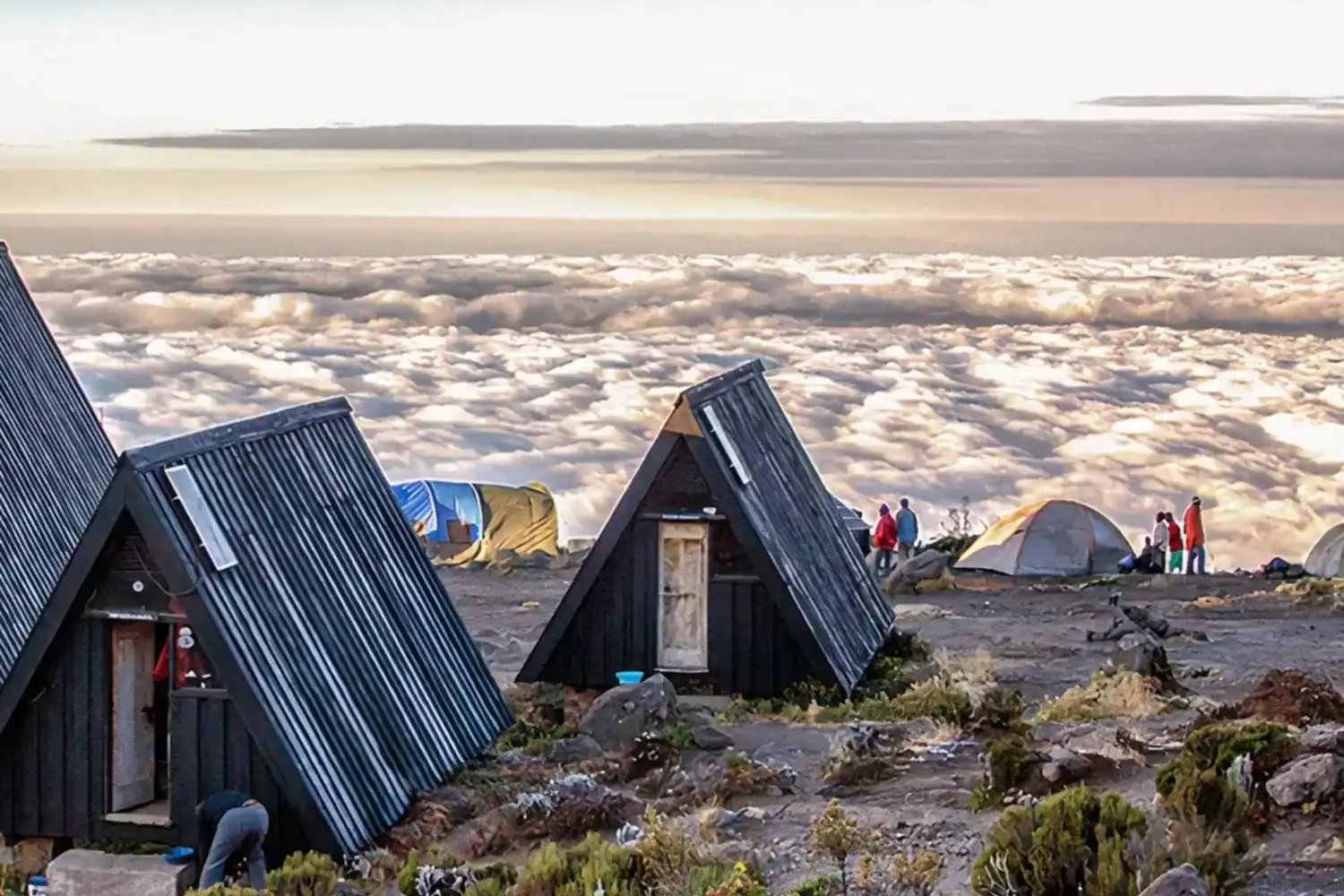
Marangu vs Rongai at a Glance
| Comparison Point | Marangu Route | Rongai Route |
|---|---|---|
| Approach side | East/southeast side of Kilimanjaro | Northern side of Kilimanjaro |
| Official route pattern | Mapped as an ascending-and-descending corridor | Northern ascent connected to the eastern/Marangu-side network |
| Overnight setup | Hut infrastructure | Designated camping on the ascent |
| Descent context | Uses the Marangu corridor | TANAPA guidance links Rongai descent with Marangu gate/network |
| Mountain environment | Both ultimately enter Kilimanjaro’s high-altitude summit environment | |
| What should not be assumed | Neither route guarantees acclimatization, summit success, dry weather, low traffic, easy conditions or a particular personal outcome | |
1. How Do the Official Route Layouts Differ?
TANAPA’s current Kilimanjaro facilities map places the Marangu Route on the east/southeast side of the mountain and shows it as an ascending-and-descending trail. The Rongai Route begins on the northern side and enters the mountain through a separate northern trail network.
TANAPA’s Mawenzi climbing guidance also identifies “Rongai route down Marangu gate,” reinforcing that the ascent side and descent side should be distinguished when comparing the two routes.
2. How Do Huts and Camping Change the Overnight Setup?
Accommodation is one of the clearest factual differences. TANAPA’s facilities map shows hut infrastructure along the Marangu network, including Mandara, Horombo and Kibo. Rongai uses designated campsites on its northern ascent.
Huts versus camping changes the sleeping and logistical arrangement, but it does not remove high-altitude exposure or make an individual outcome predictable.
3. What Is Different About the Marangu Approach?
Marangu follows the east/southeast corridor and is mapped for both ascent and descent. Its hut infrastructure is a defining operational feature of the route.
The exact itinerary length and overnight sequence should still be confirmed in writing rather than assumed from the route name alone.
4. What Is Different About the Rongai Approach?
Rongai approaches Kilimanjaro from the north, giving it a distinctly different lower-route geography from Marangu. The northern ascent uses campsites before connecting into the eastern upper network.
This geographic difference should not be turned into a universal claim that Rongai is easier, safer or more suitable for a particular traveler.
5. How Does the Descent Network Differ?
Marangu is shown by TANAPA as an ascending-and-descending route. Rongai, by contrast, is a northern ascent whose descent is associated in TANAPA guidance with the Marangu gate/network.
This means Rongai’s route identity is defined mainly by its northern approach rather than by a completely separate descent corridor.
6. Why Is High Altitude Relevant on Both Routes?
UNESCO identifies Kilimanjaro as Africa’s highest point at 5,895 metres. Both routes therefore enter a very high-altitude mountain environment on summit itineraries.
A route name cannot guarantee acclimatization or predict an individual response to altitude. Current conditions, the complete itinerary and appropriate professional assessment remain important.
7. How Do the Landscapes and Trail Perspectives Differ?
Because Marangu approaches from the east/southeast and Rongai from the north, their lower and middle trail perspectives differ. Rongai’s northern start and Marangu’s eastern corridor expose travelers to different sides of Kilimanjaro before the route systems connect higher on the mountain.
UNESCO identifies five main vegetation zones on Kilimanjaro: lower slopes, montane forest, heath and moorland, alpine desert and summit. Cloud, rain, wind and visibility can change what is actually experienced on any departure.
8. Is Rongai Always Drier Than Marangu?
No route should be marketed as weather-proof. TANAPA identifies rainy and dry periods around Kilimanjaro, but mountain weather varies with elevation, wind direction and the conditions affecting a particular departure.
Rongai’s northern approach can differ climatically from the east/southeast side, but that does not justify a guarantee of dry weather during a specific 2026/2027 trek.
9. Is Rongai Always Quieter Than Marangu?
No. Historical visitor patterns may provide background context, but they are not a live crowd forecast. Group schedules, season, park operations, hut use and campsite use can all change traffic levels.
Neither Marangu nor Rongai should therefore be sold with a guaranteed “quiet trail” or “crowded trail” promise.
10. Is Either Route Automatically Easier?
No. Hut accommodation, approach direction and trail geometry are factual differences, but none makes one route universally easy. Both are multi-day treks that enter Kilimanjaro’s high-altitude environment.
Labels such as “easy,” “gentle” or “best for beginners” can hide important differences in itinerary, weather, terrain and individual response.
11. Can Summit Success Be Predicted From the Route Name?
No. Fixed route-specific success percentages can vary by operator, itinerary length, reporting method and group profile. The official TANAPA facilities sources used here do not publish a universal route-by-route success percentage.
This page therefore avoids presenting unsupported percentages as if they guaranteed a personal outcome.
12. What Should Be Confirmed for 2026/2027?
Confirm current TANAPA route and facility information, the exact written itinerary, hut or campsite sequence, ascent and descent plan, applicable park arrangements, included services and the booking terms that apply to the selected dates.
The existing Product schema on this page contains an aggregate USD 1,300–2,900 range for two offers, but it does not provide a clear route-by-route visible price. Final package pricing and confirmed inclusions should therefore come from a current written quotation rather than from this comparison page alone.
Frequently Asked Questions About Marangu vs Rongai
How does the Marangu route compare to the Rongai route?
Marangu is the east/southeast hut-based route mapped for ascent and descent, while Rongai approaches from the north using campsites and later connects with the eastern/Marangu-side network.
Which route is easier, Marangu or Rongai?
Neither route should be described as universally easier. Route layout and accommodation differ, but both involve multi-day trekking in Kilimanjaro’s high-altitude environment.
What accommodation options are used on Marangu and Rongai?
Marangu uses hut infrastructure, while Rongai uses designated campsites on its northern ascent.
Is Rongai guaranteed to be better during rainy periods?
No. Rongai’s northern approach can experience different conditions from Marangu, but rain, cloud, wind and cold remain possible on both routes and cannot be guaranteed away.
General Kilimanjaro Information
For broader destination context, see the existing Mount Kilimanjaro overview or browse Jaynevy Tours articles and guides. Current operating details and confirmed inclusions should be provided in writing.