
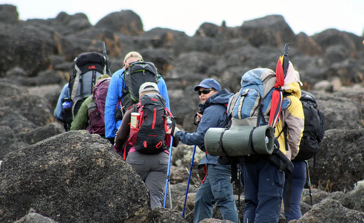
Quick Answer: What Is the 8-Day Lemosho Route Like?
The 8-day Lemosho Route is a scenic, camping-based Kilimanjaro climb with one of the most balanced standard itineraries. It starts on the western side of the mountain, crosses rainforest and the Shira Plateau, reaches about 4,600 metres near Lava Tower, sleeps lower at Barranco, and keeps Karanga as a separate overnight camp before Barafu.
It is not an easy trek. The route still reaches 5,895 metres, includes the Barranco Wall, and finishes with a long summit-and-descent day. Its main advantage is not a guaranteed success percentage; it is the extra time and better stage separation available for acclimatization, recovery and guide-led monitoring.
8-Day Lemosho Route at a Glance
The table below follows Jaynevy Tours’ published 8-day Lemosho itinerary. Distances, times and elevations are rounded planning figures. Camps can be measured at slightly different points, and weather, trail conditions and group pace affect every day.
| Day | Stage | Approx. distance | Typical time | Sleeping altitude | Main scenery |
|---|---|---|---|---|---|
| 1 | Londorossi area to Mti Mkubwa | 6 km | 3–4 hrs | 2,650 m | Montane rainforest |
| 2 | Mti Mkubwa to Shira 1 | 8 km | 5–6 hrs | 3,505 m | Forest edge and heath |
| 3 | Shira 1 to Shira 2 | 7 km | 4–5 hrs | 3,900 m | Shira Plateau and Kibo views |
| 4 | Shira 2 to Barranco via Lava Tower | 10 km | 6–8 hrs | 3,976 m | Alpine desert and Lava Tower |
| 5 | Barranco to Karanga | 7 km | 4–5 hrs | 3,995 m | Barranco Wall and Karanga Valley |
| 6 | Karanga to Barafu | 4 km | 3–4 hrs | 4,673 m | Barren high-altitude ridge |
| 7 | Barafu to Uhuru Peak to Mweka | About 16 km | 11–14 hrs | 3,100 m after summit | Summit zone and long descent |
| 8 | Mweka Camp to Mweka Gate | 10 km | 3–4 hrs | Descent to about 1,800 m | Rainforest return |
Why the Lemosho Route Is Considered So Scenic
Lemosho is not beautiful because of one viewpoint. Its appeal comes from the sequence of landscapes. The western approach starts in dense forest, reaches the open Shira Plateau, passes volcanic formations in the alpine desert, drops beneath the Breach Wall into Barranco, and then traverses the southern side of Kibo before the summit.
- Rainforest: shaded trail, giant ferns, moss-covered trees and possible colobus-monkey sightings.
- Shira Plateau: a broad high-altitude landscape formed by the remains of an older volcanic centre, with long views toward Kibo.
- Lava Tower: stark alpine desert and a useful high point in the acclimatization profile.
- Barranco Valley: dramatic cliffs, giant groundsels and one of the route’s most photographed camps.
- Southern circuit: changing views of glaciers, valleys and the plains below as the trail moves east.
- Summit zone: dark volcanic scree, cold pre-dawn conditions and the crater-rim approach to Uhuru Peak.
For a broader route overview, see the Lemosho Route guide and the dedicated explanation of Kilimanjaro’s Shira Plateau.
Camp-by-Camp Guide: What Each Overnight Stop Contributes
| Camp | Approx. altitude | Landscape | Why the camp matters |
|---|---|---|---|
| Mti Mkubwa | 2,650 m | Rainforest | First mountain night and transition from lowland travel to trekking. |
| Shira 1 | 3,505 m | Heath and plateau edge | Breaks the large western ascent before crossing the plateau. |
| Shira 2 | 3,900 m | Open plateau | Provides another night near 4,000 m before the Lava Tower exposure. |
| Barranco | 3,976 m | Valley below steep wall | Allows climbers to sleep lower after reaching Lava Tower and positions the group for the Barranco Wall. |
| Karanga | 3,995 m | Southern circuit valley | Protects a separate recovery night instead of rushing directly from Barranco to Barafu. |
| Barafu | 4,673 m | Exposed alpine ridge | Summit base; the afternoon is used for food, organisation and early rest. |
| Mweka | 3,100 m | Upper forest transition | Low recovery camp after the summit and major descent. |
Camp conditions are basic and change with weather and traffic. Lemosho uses tents rather than huts, so the quality of tents, sleeping systems, sanitation arrangements, meals and crew organisation matters. Compare those details in writing rather than judging a package only by its route name.
Day-by-Day 8-Day Lemosho Route Guide
Day 1: Londorossi Gate Area to Mti Mkubwa Camp
After registration and the transfer to the western trailhead, the trek begins under a rainforest canopy. The path can be muddy after rain, and the humidity makes the first climb feel warmer than later stages. This is usually a shorter walking day, but it follows a long gate-and-transfer process, so arriving rested still matters.
Scenery: dense forest, ferns, moss, tangled roots and occasional wildlife. Main challenge: slippery ground and the first adjustment to walking slowly with a daypack.
Day 2: Mti Mkubwa Camp to Shira 1 Camp
The trail rises out of the forest into heath and moorland. This stage produces the largest early increase in sleeping altitude: roughly 855 metres from Mti Mkubwa to Shira 1 in the published schedule. The walking is not technical, but the steady ascent and thinner air make disciplined pacing important.
Scenery: the forest opens, vegetation becomes lower and Kibo may appear above the plateau. Main challenge: a sustained climb while the body is still in the early phase of acclimatization.
Day 3: Shira 1 Camp to Shira 2 Camp
This is one of the itinerary’s most valuable pacing days. Climbers cross the open Shira Plateau rather than racing directly toward Lava Tower. The net sleeping-altitude gain is about 395 metres, allowing another night near 4,000 metres before the route goes higher.
Scenery: wide volcanic terrain, distant ridges, changing cloud layers and strong views of Kibo in clear weather. Main challenge: wind, sun exposure and the first night close to 4,000 metres.
Day 4: Shira 2 to Barranco Camp via Lava Tower
The route climbs into the alpine desert toward Lava Tower, then descends to Barranco. Although the net sleeping-altitude gain from Shira 2 is small, the body experiences a daytime high point roughly 600 to 700 metres above camp. This is the clearest “climb high, sleep lower” day on the itinerary.
Scenery: volcanic rock, sparse vegetation, Lava Tower, the Western Breach area and the descent into the greener Barranco Valley. Main challenge: the altitude exposure and long time on the trail rather than technical terrain.
Day 5: Barranco Camp to Karanga Camp
The morning begins with the Barranco Wall. Climbers use hands for balance in places, but the standard line is a guided scramble, not technical rock climbing. After topping the wall, the trail crosses undulating ground and descends into Karanga Valley before the final approach to camp.
Scenery: close views of Kibo, the Heim Glacier area, deep valleys and the southern plains. Main challenge: exposure, crowd management on the wall and repeated ascent and descent.
Day 6: Karanga Camp to Barafu Camp
The distance is short, but the sleeping-altitude gain is roughly 678 metres. The ground becomes drier, rockier and more exposed. Moving slowly is essential because a short kilometre figure can hide the effect of altitude.
After arrival, the team prepares summit clothing, headlamps, water, snacks and daypacks. Dinner and rest happen early because the summit attempt normally begins around midnight.
Day 7: Barafu Camp to Uhuru Peak and Down to Mweka Camp
This is the decisive and hardest day. The climb begins in darkness on steep volcanic scree. Climbers usually reach Stella Point on the crater rim before following the final ridge to Uhuru Peak. After a short summit stop, the group descends past Barafu and continues to Mweka Camp around 3,100 metres.
Scenery: stars, sunrise, crater-rim views, glaciers and then a dramatic return through several ecological zones. Main challenge: cold, altitude, sleep loss and the long descent on tired legs.
Summit Safety Comes Before the Schedule
Reaching the summit is never more important than responding to symptoms. A climber with worsening altitude illness should not be encouraged to continue simply because the group is close to the top. Guide instructions and descent decisions take priority.
Day 8: Mweka Camp to Mweka Gate
The final walk descends through forest to Mweka Gate. The oxygen level feels noticeably better, but wet roots, mud and tired knees can make the descent slower than expected. At the gate, the team completes park formalities before the road transfer.
Scenery: rainforest, birds, dense vegetation and the return to warmer conditions. Main challenge: protecting knees and ankles after the previous day’s long descent.
How the 8-Day Lemosho Acclimatization Profile Works
The route does not rise at a perfectly even rate. Mountain terrain rarely allows that. Instead, the itinerary combines extra nights, modest net gains on several days and the Lava Tower exposure followed by a lower Barranco sleep.
| Night | Camp | Sleeping altitude | Approx. change from previous night |
|---|---|---|---|
| 1 | Mti Mkubwa | 2,650 m | First mountain night |
| 2 | Shira 1 | 3,505 m | +855 m |
| 3 | Shira 2 | 3,900 m | +395 m |
| 4 | Barranco | 3,976 m | +76 m after hiking near 4,600 m |
| 5 | Karanga | 3,995 m | +19 m |
| 6 | Barafu | 4,673 m | +678 m |
| 7 | Mweka | 3,100 m | −1,573 m after the summit |
The CDC explains that acute acclimatization develops mainly over the first three to five days and advises gradual increases in sleeping altitude. Above 3,000 metres, its general guidance recommends no more than about 500 metres of sleeping-altitude gain per night and an extra acclimatization night for every additional 1,000 metres. Kilimanjaro’s fixed camps do not match that guidance perfectly, which is one reason longer itineraries and symptom-based decisions matter.
Fitness helps you walk, but it does not predict who will develop altitude illness. Review Kilimanjaro acclimatization guidance and discuss personal health questions with a qualified clinician before travel.
What Published Kilimanjaro Research Shows
Useful Numbers Without False Guarantees
- A prospective cohort included 1,237 recreational Kilimanjaro hikers. In that group, 87.9% reached Uhuru Peak, 8.6% developed severe altitude-illness symptoms and 1.1% were hospitalized.
- In the same study, climbing in more days predicted summit success. This supports longer itineraries in general; it does not create a universal audited success rate for every eight-day Lemosho departure.
- CDC guidance notes that inspired oxygen pressure at approximately 3,050 metres is about 69% of the sea-level value. Kilimanjaro rises far above that point to 5,895 metres.
- The CDC specifically advises adding at least one to two days to planned Kilimanjaro ascents when possible because extra time facilitates acclimatization regardless of route.
Correct interpretation: eight days provides a stronger schedule than compressed alternatives, but it does not justify promising that every climber has a 90%, 95% or 98% chance of success. A company-specific figure is meaningful only when the operator discloses the sample size, years measured, summit definition and whether every starting climber was counted.
How Difficult Is the 8-Day Lemosho Route?
For most healthy, prepared trekkers, the route is moderate to very challenging. It is non-technical in standard conditions, but non-technical does not mean easy. The difficulty comes from cumulative walking, camping, cold, large altitude gain and summit day.
| Factor | Practical effect | How the 8-day schedule helps |
|---|---|---|
| Altitude | Headache, poor sleep, appetite change and reduced pace can occur. | Adds time and protects several separate camp stages. |
| Summit day | Roughly 11–14 hours with a midnight start. | Separate Karanga night reduces workload immediately before Barafu. |
| Barranco Wall | Steep scramble and exposure. | Shorter overall day than itineraries continuing directly to Barafu. |
| Camping | Cold nights, limited washing and variable sleep. | No direct reduction; good equipment and crew systems matter. |
| Weather | Rain, wind, dust, cold and strong sun may occur on one trip. | More time does not control weather, but less compressed days can improve recovery. |
Use the common Kilimanjaro challenges guide to prepare for the realities that route names and distance tables do not show.
What Camping and Weather Feel Like
The route passes through several climate zones in a week. Rainforest days can be wet and humid; Shira can be sunny, windy and cold within hours; the alpine desert is dry and exposed; and Barafu and the summit can be below freezing. A single weather forecast cannot represent the whole route.
- Use a waterproof duffel liner even when the outer bag is described as water resistant.
- Keep rainwear, warm layers, gloves, water and sun protection in the daypack.
- Use a sleeping bag appropriate for cold mountain nights and confirm whether it is included or rented.
- Expect tents and boots to collect dust in dry periods and mud in wet periods.
- Confirm toilet, water-treatment and hygiene arrangements before booking.
Work through the complete Kilimanjaro packing checklist and the Mount Kilimanjaro safety guide rather than buying equipment from a generic hiking list.
Who Should Choose the 8-Day Lemosho Route?
It is a strong choice for:
- First-time Kilimanjaro climbers who can commit to the longer schedule.
- Travellers living near sea level or with limited previous high-altitude exposure.
- Photographers and scenery-focused trekkers who want time on the Shira Plateau.
- Climbers who prefer a separate Karanga night before Barafu.
- Groups with mixed walking speeds that benefit from less compressed stages.
It may not be the right choice when:
- Your total trip cannot accommodate eight mountain days plus arrival and recovery time.
- You dislike camping and would prefer the hut-based Marangu Route.
- Your health assessment indicates that a high-altitude climb is unsuitable.
- You expect the extra day to remove all risk or guarantee the summit.
Compare alternatives through the Kilimanjaro route comparison before selecting an itinerary only because it is popular.
What Determines the Cost of an 8-Day Lemosho Climb?
The price is not simply a fee for eight days of walking. It includes protected-area fees, camping logistics, guide and crew wages, food, fuel, transport, equipment, rescue arrangements and administration. Group size, private versus joining departure, service level, pre- and post-climb accommodation and rental equipment change the total.
Request a written quotation showing all inclusions and exclusions. Compare offers using the Kilimanjaro climbing cost guide. An unusually low quote should be checked for missing park fees, insufficient crew support, poor equipment, excluded transfers or unclear tipping expectations.
Questions to Ask Before Booking
- Is the full camp sequence Mti Mkubwa, Shira 1, Shira 2, Barranco, Karanga, Barafu and Mweka?
- Which daily distances and camp elevations does the operator use, and are they estimates?
- How are symptoms recorded and what is the guide-to-climber ratio?
- What emergency communication, oxygen and evacuation arrangements are available?
- Which tents, sleeping mats, dining equipment and toilet arrangements are included?
- Are park fees, rescue fees, transfers, hotels and crew wages included?
- What happens when weather, illness or park instructions require an itinerary change?
- How does the operator calculate any advertised summit-success percentage?
Final Verdict: Is the 8-Day Lemosho Route a Good Choice?
Yes, for most climbers who want Lemosho, eight days is the best default schedule. It preserves the Shira 1 and Shira 2 progression, uses Lava Tower before a lower Barranco sleep, protects Karanga as a separate camp and gives the group a short approach to Barafu.
Its value is the structure, not a marketing promise. The climb remains demanding, altitude symptoms remain possible and summit decisions must remain with trained guides. Choose it for the scenery, measured pace and camp sequence—not because anyone claims the mountain is guaranteed.
Frequently Asked Questions
Is the 8-day Lemosho Route suitable for beginners?
It can suit fit beginners who train consistently, choose suitable equipment and follow guide instructions. The extra time supports acclimatization, but the climb still includes steep ground, cold conditions and a long summit day.
How long is the 8-day Lemosho Route?
Jaynevy Tours publishes an itinerary of approximately 58 kilometres. GPS tracks and operator camp positions vary, so total figures should be treated as planning estimates rather than exact measurements.
What camps are used on the 8-day Lemosho Route?
A common sequence is Mti Mkubwa, Shira 1, Shira 2, Barranco, Karanga, Barafu and Mweka, followed by a descent to Mweka Gate on Day 8.
What is the highest sleeping camp on the route?
Barafu Camp is the highest planned sleeping camp in this itinerary at approximately 4,673 metres, although published elevations vary slightly among operators.
Why does the route visit Lava Tower?
The route climbs to approximately 4,600 metres near Lava Tower and then descends to sleep at Barranco around 3,976 metres. This climb-high-sleep-lower profile provides useful altitude exposure without keeping the same high sleeping elevation.
How difficult is the Barranco Wall?
The Barranco Wall is steep and requires hands for balance in several places, but it is normally a scramble rather than technical rock climbing. Guides manage spacing and choose the safest line.
Does eight days guarantee reaching Uhuru Peak?
No. A longer itinerary can improve pacing and acclimatization opportunities, but individual physiology, symptoms, weather, health and guide decisions still affect the outcome.
What is the hardest day on the 8-day Lemosho Route?
Day 7 is usually the hardest because climbers start around midnight, ascend from Barafu to Uhuru Peak and then descend to Mweka Camp. The combined day can take roughly 11 to 14 hours.
Do I need previous mountaineering experience?
Technical mountaineering experience is not normally required for the standard route, but previous multi-day hiking experience is valuable. Climbers need endurance, leg strength, cold-weather preparation and realistic expectations.
When should I choose a shorter Lemosho itinerary?
Choose a shorter schedule only after comparing the exact camp sequence and discussing your altitude history, time limits and trekking experience. The number of days alone does not show which stages have been compressed.
Research and Planning Sources
This guide was reviewed on 6 August 2026. Route distances, hiking times and camp elevations are rounded because published itineraries and GPS measurements vary. Medical information is general and does not replace advice from a qualified clinician.
- CDC Yellow Book: High-Altitude Travel and Altitude Illness
- CDC Yellow Book: African Safaris and Climbing Expeditions
- Prospective cohort study of 1,237 recreational Kilimanjaro hikers
- Jaynevy Tours: published eight-day Lemosho itinerary
- Google Search Central: helpful, reliable, people-first content
- Google Search Central: generative AI search guidance